I hiked up Lookout Mountain today. Change in elevation from base to summit was 475 feet over a 0.6 mile hike. Starting at the northern car park it took 13.5 minutes to the summit and then 7.5 minutes back with a 10 minute break at the top.
Now you may be asking yourself "how the hell did he get an aerial photo of Lookout Mountain if he was hiking up it?"
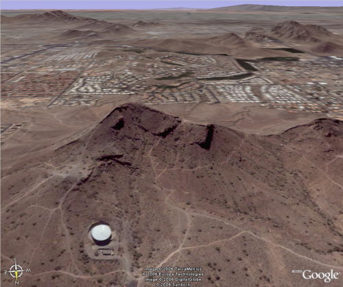
I used a neat feature on Google Earth that allows you to tilt the picture and if you have the terrain setting switched on it will show it to you in 3D. The image shows a water tower in the bottom left hand corner and also the zigzag path we took to the saddle before turning left to the summit. This image is taken from north of the mountain looking south.
If anybody else has hiked this I'd be interested to know what sort of times it has taken you from the northern car park to summit and back. You can post your times in the comments.
No comments:
Post a Comment